PROFILE ON GARHWAL
Introduction: Garhwal lies in lap newly formed state of Uttranchal which came into existence in 2000 AD. Before it was a part of Uttar Pradesh, It borders those of Tibet, Kumaon, Uttar Pradesh and Himachal Pradesh; this is the land where the river Ganga, Yamuna, Alaknanda and Mandakani are born.
Garhwal is known as one of the beautiful lands in the whole of Asia.
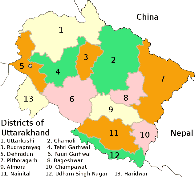
This region is made up of Chamoli, Dehradun, Pauri, Tehri, Uttarkashi, Haridwar and a new districts called Rudraprayag (before it was a part of Pauri and Chamoli). Garhwal consists of these districts with the total population of about 5 million people. About 80% of them speak Garhwali, a distinct language. There are almost 12,000 villages. Access to many of the villages can be merely mule tracks of footpaths in the mountains. Some of the villages are even snowbound for up to four months a year. Logistics and communication to get the gospel to them is therefore not easy.
Spiritually this land is considered to be the holiest land in the Himalaya Garhwal is land of two main centers, Badrinath and Kedarnath, where the holy shrines are situated, haridwar and Risikesh also comes in this area, where people go to get the deeper study of Hinduism and is influencing people to visit these places and also this is the center for Yoga which is attracting people from the west. Besides this there are hundreds of ancient temples and shrines of religious importance for the Hindus, Sikhs and Buddhists, Garhwal also source of rivers Ganga (Ganges) and Yamuna, considered by Hindus to be most holy in India.
The proportional distributions of the ethnic groups of Garhwal are listed below:
Class / Caste / Ethnic group
(% of Total)
Brahmins: 25%
Rajputs: 55%
Dalit: 10%
Tribal: 5%
Others: 5%
Total: 100%
